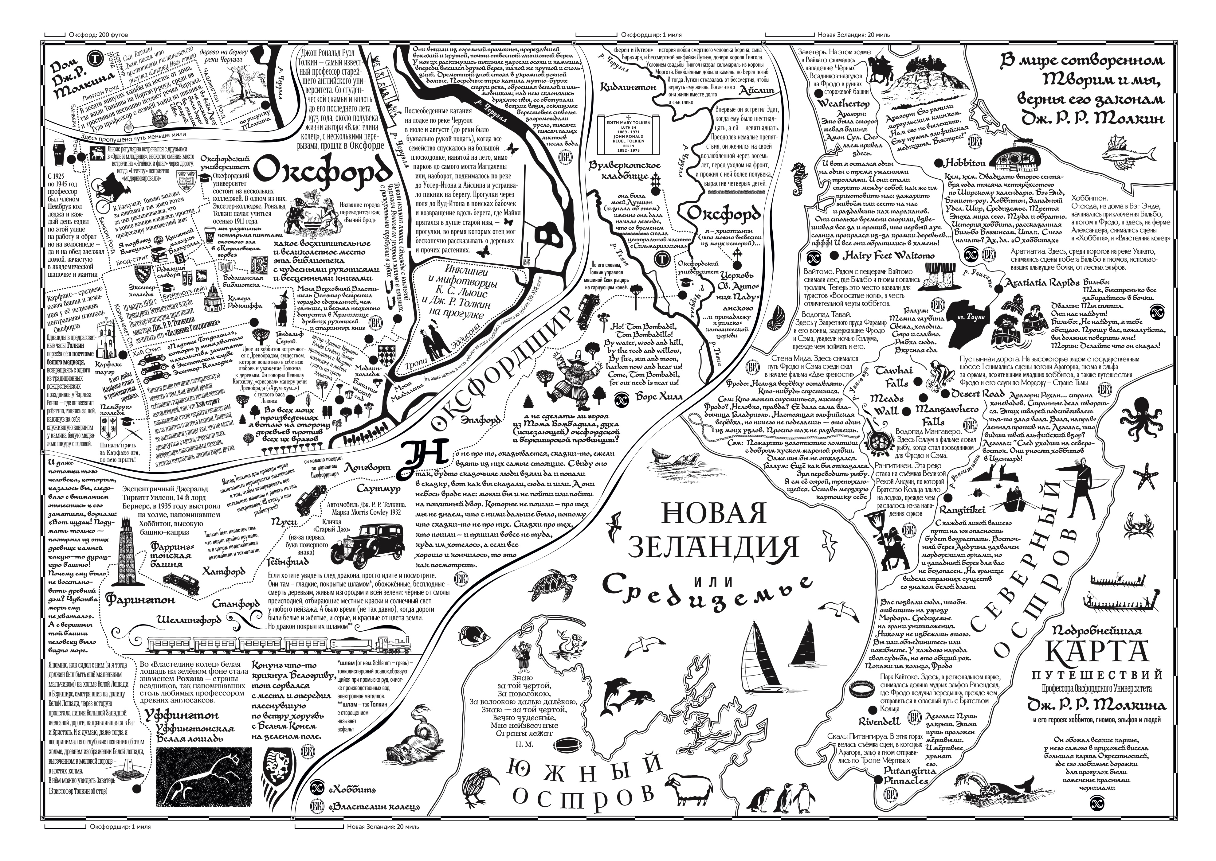
At the end of March of this year, I received a travel magazine called “Nomer” with a fantastic and incredibly challenging proposal: to create a map of Tolkien’s travels and those of his characters.
In this context, the following were considered travels: the professor’s walks around Oxford; family trips around Oxfordshire; the fictional journeys of Bilbo and Frodo; and the travel photographer’s trip to the filming locations of “The Hobbit” and “The Lord of the Rings” in New Zealand.
The map combines three real spaces and one fictional one. The development proceeds in three scales, from the upper left corner to the lower right. We start in Oxford (the scale is shown on the map’s frame).
In the very corner is Tolkien’s house on Northmoor Road. Then there’s a gap of about a mile — and the map shows the centre of Oxford with the university. Scale: one division equals 200 feet.
As we move down and to the right, the camera pulls back, and we see the whole of Oxfordshire: one division equals 1 mile.
Further on, another boundary — and we’re already among the antipodes, on the North Island of New Zealand. The scale jumps by 20 miles.
About the font. Specifically for the project, I looked through a hundred sheets of Tolkien’s calligraphy, scanned a couple of dozen, selected the most expressive letters, and based on them, I created JRRT Uncial — an uncial script that includes two of the professor’s handwritings. The Cyrillic alphabet, of course, is mine.
Developing the font wasn’t part of the order, but how could I resist when the hero himself invited me?
The map was started on March 31 and completed on May 18. I still can’t believe that such a project could be done in a month and a half.